FE 257 is an introduction to the appropriate use and potential applications of geographic information systems (GIS) and related technologies (GPS and remote sensing) in forest management, operations planning, and problem solving. Students are presented with lectures and exercises that cover a wide range of GIS and GIS-related topics and issues including spatial database creation, structure, analysis, and modeling. Class meetings include lectures and hands-on GIS exercises in a computer lab. Students are required to complete weekly lab assignments and a final project.

Students will need to purchase a copy of:
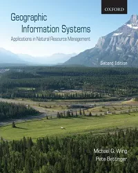
Geographic Information Systems: Applications in Forestry and Natural Resource Management
Geographic Information Systems
Authors: Michael G. Wing, Oregon State University
Pete Bettinger, University of Georgia
Publisher: Oxford
ISBN: 978-0-19-542610-6
Description: ©2008 / Softcover / 272 pages
Class presentation notes
Instructor:
Michael Wing
Registered Professional Land Surveyor: Oregon
Registered Professional Engineer: Oregon
Registered Water Rights Examiner: Oregon
Associate Professor, Forest Engineering, Resources, and Management
Oregon State University
Crop Science 347
Michael.Wing at oregonstate.edu
Office hours: Monday: 1:00-3:00
Graduate Teaching Assistants:
Matt Barker
matthew.barker@oregonstate.edu
Office hours: Monday 12-2 RH 207.
Katie Nicolato
katharine.nicolato@oregonstate.edu
Office hours: Tu 12 – 2 PM. Rich 313.
Cory Garms
Office hours: Thur 2-4. Rich 313.
WWW spatial data sources
Oregon Geospatial Enterprise Office - The place to start your hunt for Oregon spatial data
Other data sources provided by the above organization
Oregon Explorer Natural Resources Digital Library
Siuslaw National Forest GIS Data
Multi-Resolution Land Characteristics Consortium
Coastal Landscape Analysis and Modeling Study
Willamette River Basin Mapping Project
USGS Water Resources of Oregon
Washington State Department of Ecology